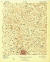
1950 Map of Palestine
USGS Topo · Published 1950About this map
Palestine serves as the regional hub for Anderson County in the mid-twentieth century, dominated by a dense grid of schools including Crockett High Sch, Alamo Sch, and Lincoln Sch. The Missouri Pacific railroad cuts through the terrain, connecting the town to the surrounding countryside where agricultural life is centered on a network of small churches and academies. Small settlements like Montalba, Elmwood, and Pert are scattered among the ridges and wetlands.
Find a feature on this map
77 named features on this map. Tap any name to fly to it.
Don’t see what you’re looking for? This feature index may not catch every label — zoom into the map to look around manually.
Map Details
Editions of this 1950 Palestine Map
2 editions found
Other maps of this area

1946 · Bullard
USGS Topo · 1:62,500

1948 · Bullard
USGS Topo · 1:62,500

1949 · Palestine
USGS Topo · 1:62,500

1949 · Frankston
USGS Topo · 1:62,500

1949 · Athens
USGS Topo · 1:62,500

1949 · Tennessee Colony
USGS Topo · 1:62,500

1950 · Athens
USGS Topo · 1:62,500

1950 · Palestine
USGS Topo · 1:62,500

1950 · Frankston
USGS Topo · 1:62,500

1950 · Tennessee Colony
USGS Topo · 1:62,500