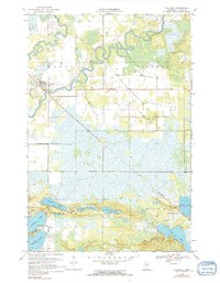
1970 Map of Palisade
USGS Topo · Published 1991About this map
The Mississippi River meanders sharply through the northern reaches of this Aitkin County landscape, defining the character of the Logan and Workman townships. The village of Palisade sits along the river's western banks, established where the Soo Line railroad cuts diagonally across the terrain toward the southeast. This period shows a community deeply integrated with its water and rail access, featuring a local Townhall and a designated Picnic Area near the village center.
Find a feature on this map
17 named features on this map. Tap any name to fly to it.
Don’t see what you’re looking for? This feature index may not catch every label — zoom into the map to look around manually.
Map Details
Editions of this 1970 Palisade Map
2 editions found
Other maps of this area

1914 · Aitkin
USGS Topo · 1:62,500

1915 · Aitkin
USGS Topo · 1:62,500

1953 · Duluth
USGS Topo · 1:250,000

1958 · Duluth
USGS Topo · 1:250,000

1970 · Kimberly
USGS Topo · 1:24,000

1970 · Mc Gregor
USGS Topo · 1:24,000

1970 · Palisade
USGS Topo · 1:24,000

1970 · Sanders Lake
USGS Topo · 1:24,000

1970 · Libby
USGS Topo · 1:24,000
1970 · Minnewawa
USGS Topo · 1:24,000