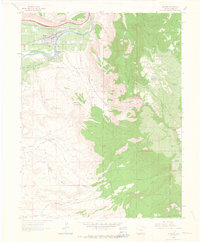
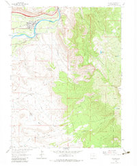
1962 Map of Palisade
USGS Topo · Published 1964About this map
Palisade stands as a hub of irrigation and industry along the north bank of the Colorado River, where the Denver and Rio Grande Western Railroad follows the water's edge. This early 1960s survey captures the region's complex resource economy, balancing the extensive orchards of East Orchard Mesa with the subterranean activity of the Palisade Mines, Farmers Mine, and Midwest Mine. The landscape shifts abruptly from the fertile river valley to the towering heights of the Grand Mesa and the Grand Mesa National Forest, where high-altitude water management is evident through systems like Palisade Res No 2 and Cliff Lake Reservoir. The terrain is marked by distinctive geological features such as The Blowout and Horse Mountain, while numerous jeep trails wind through Halls Basin, providing access to isolated mining claims like the Blackbird Mine.
Find a feature on this map
33 named features on this map. Tap any name to fly to it.
Don’t see what you’re looking for? This feature index may not catch every label — zoom into the map to look around manually.
Map Details
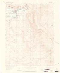
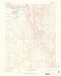
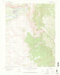
Editions of this 1962 Palisade Map
5 editions found
Other maps of this area
1955 · Cameo
USGS Topo · 1:24,000
1955 · Mesa
USGS Topo · 1:24,000

1956 · Moab
USGS Topo · 1:250,000

1956 · Grand Junction
USGS Topo · 1:250,000

1959 · Grand Junction
USGS Topo · 1:250,000

1959 · Moab
USGS Topo · 1:250,000

1960 · Moab
USGS Topo · 1:250,000

1960 · Grand Junction
USGS Topo · 1:250,000

1962 · Moab
USGS Topo · 1:250,000

1962 · Grand Junction
USGS Topo · 1:250,000