1962 Map of Palisade
USGS Topo · Published 1972About this map
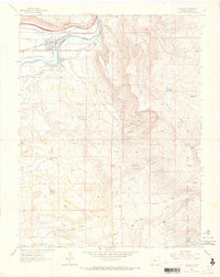
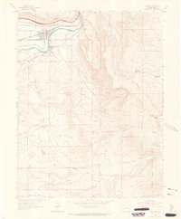
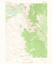
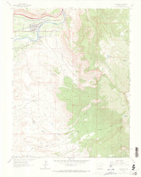
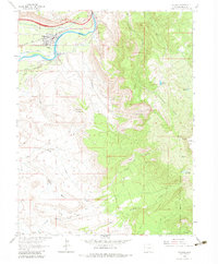
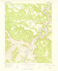
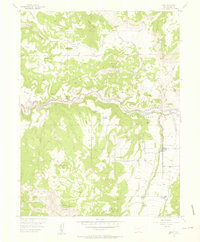
Palisade sits at the foot of the dramatic Western Slope, where the Colorado River carves a path through the valley. This 1962 field check reveals a landscape defined by an intricate network of irrigation systems essential to the region's famous fruit orchards, including the Government High Line Canal, Stub Ditch, and Orchard Mesa Canal No 2. Beyond the agricultural flats of Orchard Mesa, the terrain rises sharply toward Grand Mesa and the Grand Mesa National Forest, marked by geologic features like The Blowout and Horse Mountain.
Find a feature on this map
42 named features on this map. Tap any name to fly to it.
Don’t see what you’re looking for? This feature index may not catch every label — zoom into the map to look around manually.
Map Details
Editions of this 1962 Palisade Map
5 editions found
Other maps of this area
1955 · Cameo
USGS Topo · 1:24,000
1955 · Mesa
USGS Topo · 1:24,000

1956 · Moab
USGS Topo · 1:250,000

1956 · Grand Junction
USGS Topo · 1:250,000

1959 · Grand Junction
USGS Topo · 1:250,000

1959 · Moab
USGS Topo · 1:250,000

1960 · Moab
USGS Topo · 1:250,000

1960 · Grand Junction
USGS Topo · 1:250,000

1962 · Moab
USGS Topo · 1:250,000

1962 · Grand Junction
USGS Topo · 1:250,000