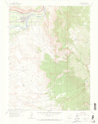
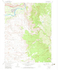
1962 Map of Palisade
USGS Topo · Published 1972About this map
Palisade occupies the fertile bend of the Colorado River, where a complex irrigation network including the Government High Line Canal, Price Ditch, and Western Canal turned the arid valley into a productive agricultural center. The town's economy in the early 1960s was clearly defined by this balance of water management and industrial extraction, as seen in the concentration of coal works like the Mt Lincoln Mine and Midwest Mine along the northern bluffs.
Find a feature on this map
46 named features on this map. Tap any name to fly to it.
Don’t see what you’re looking for? This feature index may not catch every label — zoom into the map to look around manually.
Map Details
Editions of this 1962 Palisade Map
5 editions found
Other maps of this area

1955 · Cameo
USGS Topo · 1:24,000

1955 · Mesa
USGS Topo · 1:24,000

1956 · Moab
USGS Topo · 1:250,000

1956 · Grand Junction
USGS Topo · 1:250,000

1959 · Grand Junction
USGS Topo · 1:250,000

1959 · Moab
USGS Topo · 1:250,000

1960 · Moab
USGS Topo · 1:250,000

1960 · Grand Junction
USGS Topo · 1:250,000

1962 · Moab
USGS Topo · 1:250,000

1962 · Grand Junction
USGS Topo · 1:250,000