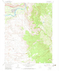
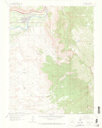
1962 Map of Palisade
USGS Topo · Published 1983About this map
The Colorado River carves a vital corridor through this landscape, fueling a complex network of irrigation and industry. In the 1960s, the town of Palisade and the nearby settlement of Taylor thrive on the agricultural productivity of Orchard Mesa and East Orchard Mesa, where the Government Highline Canal and Orchard Mesa Canal No 1 sustain local fruit production. The presence of the Denver and Rio Grande Western railroad underscores the area's role as a transport hub for both produce and coal.
Find a feature on this map
46 named features on this map. Tap any name to fly to it.
Don’t see what you’re looking for? This feature index may not catch every label — zoom into the map to look around manually.
Map Details
Editions of this 1962 Palisade Map
5 editions found
Other maps of this area

1955 · Cameo
USGS Topo · 1:24,000

1955 · Mesa
USGS Topo · 1:24,000

1956 · Moab
USGS Topo · 1:250,000

1956 · Grand Junction
USGS Topo · 1:250,000

1959 · Grand Junction
USGS Topo · 1:250,000

1959 · Moab
USGS Topo · 1:250,000

1960 · Moab
USGS Topo · 1:250,000

1960 · Grand Junction
USGS Topo · 1:250,000

1962 · Moab
USGS Topo · 1:250,000

1962 · Grand Junction
USGS Topo · 1:250,000