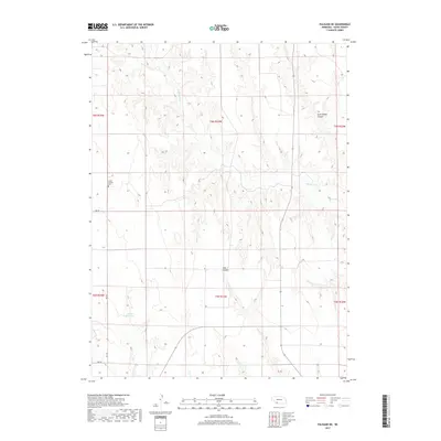
2017 Map of Palisade NE
USGS Topo · Published 2017About this map
Union Mission Cem sits on a high point overlooking the rolling divides of Hayes County, marking a localized pocket of settlement in this agricultural landscape. The terrain is defined by the drainage systems of Blackwood Cr, which cuts through the northern and eastern portions of the map, carving out significant landforms such as Government Canyon and Fish Canyon. This 2017 survey reveals a rural network of section-line roads including Ave 359 and Rd 732, which facilitate movement between isolated homesteads and ranching operations. The presence of Smith Reservoir in the southwestern quadrant highlights the critical role of water management and irrigation in maintaining the productivity of these Nebraska plains. The map reflects a persistent pattern of rural life where legacy names and small-scale infrastructure remain the primary markers of human activity.
Find a feature on this map
14 named features on this map. Tap any name to fly to it.
Don’t see what you’re looking for? This feature index may not catch every label — zoom into the map to look around manually.
Map Details
Editions of this 2017 Palisade NE Map
This is the sole edition of this map. No revisions or reprints were ever made.
Other maps of this area

1954 · McCook
USGS Topo · 1:250,000

1957 · McCook
USGS Topo · 1:250,000

1958 · McCook
USGS Topo · 1:250,000

1973 · Palisade
USGS Topo · 1:24,000
1973 · Beverly
USGS Topo · 1:24,000

1973 · Palisade SW
USGS Topo · 1:24,000
1973 · Burger Canyon West
USGS Topo · 1:24,000

1974 · Hamlet
USGS Topo · 1:24,000

1974 · Hayes Center
USGS Topo · 1:24,000
1974 · Palisade NE
USGS Topo · 1:24,000