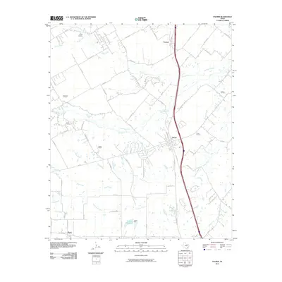
2010 Map of Palmer
USGS Topo · Published 2010About this map
The town of Palmer serves as the central hub of this Ellis County landscape, where the convergence of several major watercourses like Red Oak Creek and Brushy Creek has long influenced the local geography. This survey documents the area's transition into the early 21st century, showing the established grid of the town alongside the more scattered settlements of Trumbull to the north and Boyce to the southwest. The presence of several family and community burial grounds, including the Cottonwood Cemetery, Douglas Cemetery, and the Prude Hyde Cemetery, provides a wealth of data for genealogists tracing local lineage.
Find a feature on this map
65 named features on this map. Tap any name to fly to it.
Don’t see what you’re looking for? This feature index may not catch every label — zoom into the map to look around manually.
Map Details
Editions of this 2010 Palmer Map
This is the sole edition of this map. No revisions or reprints were ever made.
Other maps of this area

1891 · Dallas
USGS Topo · 1:125,000

1893 · Dallas
USGS Topo · 1:125,000

1954 · Dallas
USGS Topo · 1:250,000

1956 · Ennis
USGS Topo · 1:62,500

1958 · Dallas
USGS Topo · 1:250,000

1959 · Lancaster
USGS Topo · 1:24,000

1959 · Ferris
USGS Topo · 1:24,000

1959 · India
USGS Topo · 1:24,000

1959 · Seagoville
USGS Topo · 1:62,500

1961 · Forreston
USGS Topo · 1:24,000