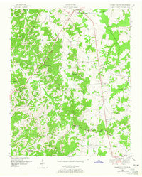
1950 Map of Palmer Shelter
USGS Topo · Published 1965About this map
The Tennessee Valley Divide snakes through the southern portion of this Carroll County landscape, marking the hydrological boundary between major drainage basins. This mid-century survey reveals a rural society organized around crossroads communities and local institutions. Small settlements like Leach and Palmer Shelter are anchored by a network of country churches and schools, including Davis Chapel, Anark Ch, and the Scott Hill School. The land is dissected by numerous waterways, such as Beaver Creek and Roan Creek, with the Beaver Drainage Canal indicating early 20th-century efforts to manage the low-lying bottomlands for agriculture. Genealogists will find a wealth of family-named landmarks and resting places, such as Spillers Cem, Giles Cem, and Blair Cem, which document the ancestral footprint of this West Tennessee region during the post-war era.
Find a feature on this map
59 named features on this map. Tap any name to fly to it.
Don’t see what you’re looking for? This feature index may not catch every label — zoom into the map to look around manually.
Map Details
Editions of this 1950 Palmer Shelter Map
3 editions found
Other maps of this area

1936 · Clarksburg
USGS Topo · 1:24,000

1936 · Yuma
USGS Topo · 1:24,000

1936 · Vale
USGS Topo · 1:24,000

1936 · Center Ridge
USGS Topo · 1:24,000

1936 · Buena Vista
USGS Topo · 1:24,000

1950 · Yuma
USGS Topo · 1:24,000

1950 · Palmer Shelter
USGS Topo · 1:24,000

1950 · Vale
USGS Topo · 1:24,000
1950 · Buena Vista
USGS Topo · 1:24,000

1950 · Clarksburg
USGS Topo · 1:24,000