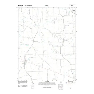
2010 Map of Palmyra
USGS Topo · Published 2010About this map
Palmyra and Martinsburg anchor this survey of southern Washington County, where the landscape is defined by the winding course of the South Fork Blue River and its numerous tributaries. The rural character of the area is evident in the network of family-named roads and scattered burial grounds, including the Voyles Cemetery, Rickerd Cemetery, and Goss Cemetery. These sites provide critical touchpoints for genealogists tracing the legacy of early settlers in this pocket of southern Indiana.
Find a feature on this map
74 named features on this map. Tap any name to fly to it.
Don’t see what you’re looking for? This feature index may not catch every label — zoom into the map to look around manually.
Map Details
Editions of this 2010 Palmyra Map
This is the sole edition of this map. No revisions or reprints were ever made.
Other maps of this area

1939 · Georgetown
USGS Topo · 1:24,000

1941 · Borden
USGS Topo · 1:24,000

1946 · Depauw
USGS Topo · 1:24,000

1947 · Georgetown
USGS Topo · 1:24,000

1949 · Georgetown
USGS Topo · 1:24,000

1950 · Salem
USGS Topo · 1:24,000

1950 · Becks Mill
USGS Topo · 1:24,000

1950 · Palmyra
USGS Topo · 1:24,000
1952 · Georgetown
USGS Topo · 1:24,000

1953 · Fredericksburg
USGS Topo · 1:24,000