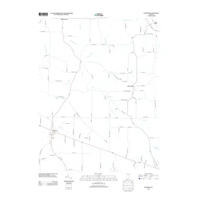
2013 Map of Palmyra
USGS Topo · Published 2013About this map
The town of Palmyra serves as a central hub in this southern Indiana landscape, where State Road 150 and State Road 135 intersect. To the northeast, the settlement of Old Pekin and the small community of Martinsburg anchor the local geography. The area is defined by a dense network of watercourses, including the S Fork Blue River and its various tributaries such as Bear Cr and Dutch Cr.
Find a feature on this map
108 named features on this map. Tap any name to fly to it.
Don’t see what you’re looking for? This feature index may not catch every label — zoom into the map to look around manually.
Map Details
Editions of this 2013 Palmyra Map
This is the sole edition of this map. No revisions or reprints were ever made.
Other maps of this area

1939 · Georgetown
USGS Topo · 1:24,000

1941 · Borden
USGS Topo · 1:24,000

1946 · Depauw
USGS Topo · 1:24,000

1947 · Georgetown
USGS Topo · 1:24,000

1949 · Georgetown
USGS Topo · 1:24,000

1950 · Salem
USGS Topo · 1:24,000

1950 · Becks Mill
USGS Topo · 1:24,000

1950 · Palmyra
USGS Topo · 1:24,000
1952 · Georgetown
USGS Topo · 1:24,000

1953 · Fredericksburg
USGS Topo · 1:24,000