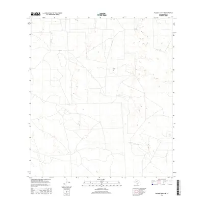
2016 Map of Palomas Ranch SE
USGS Topo · Published 2016About this map
Perez Cem serves as a small but vital anchor for family history in this corner of Brooks County, where the landscape is defined by vast tracts of ranchland and a sparse network of county roads. The terrain is marked by the subtle, rolling contours and ephemeral drainage patterns typical of the South Texas sand sheet. A system of unpaved routes, including Co Rd 408, Co Rd 409, and Co Rd 406, crisscrosses the open country, tracing the boundaries between large private holdings. This modern survey illustrates the enduring nature of the ranching economy, showing how historical property lines and family landmarks remain the primary features of the local geography.
Find a feature on this map
6 named features on this map. Tap any name to fly to it.
Don’t see what you’re looking for? This feature index may not catch every label — zoom into the map to look around manually.
Map Details
Editions of this 2016 Palomas Ranch SE Map
This is the sole edition of this map. No revisions or reprints were ever made.
Other maps of this area

1921 · Falfurrias
USGS Topo · 1:125,000

1939 · Encantada
USGS Topo · 1:62,500

1949 · Mc Allen
USGS Topo · 1:250,000

1954 · McAllen
USGS Topo · 1:250,000

1956 · Laredo
USGS Topo · 1:250,000

1957 · Mc Allen
USGS Topo · 1:250,000

1962 · McAllen
USGS Topo · 1:250,000

1963 · Cage Ranch
USGS Topo · 1:24,000
1963 · Encino
USGS Topo · 1:24,000

1963 · Falfurrias
USGS Topo · 1:24,000