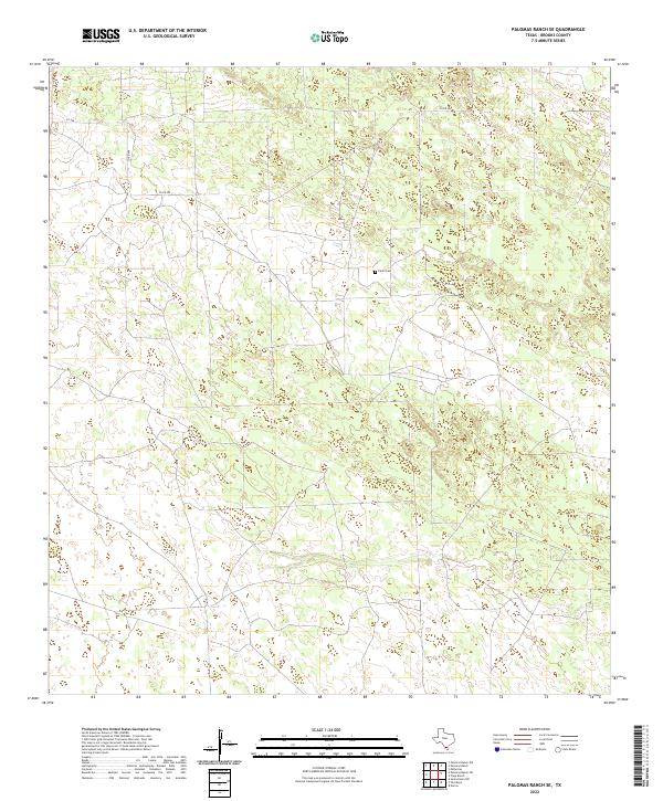
2022 Map of Palomas Ranch SE
USGS Topo · Published 2022About this map
Brooks County ranch lands are documented here with a focus on rural land division and remote access. The landscape is characterized by its isolation and the sparse network of dirt and gravel roads that connect disparate parcels of Texas brush country. A central point of local genealogical interest is the Perez Cem, a small burial ground located in the northeastern portion of the sheet. The area is largely defined by private ranching interests, with connectivity provided by routes such as Co RD 409 and Co RD 408. These corridors represent the primary infrastructure for agricultural operations in this part of South Texas, where the terrain is marked by gentle elevation changes and subtle water features. This contemporary survey serves as a vital record of land ownership and rural boundaries in a region where few permanent settlements exist.
Find a feature on this map
6 named features on this map. Tap any name to fly to it.
Don’t see what you’re looking for? This feature index may not catch every label — zoom into the map to look around manually.
Map Details
Editions of this 2022 Palomas Ranch SE Map
This is the sole edition of this map. No revisions or reprints were ever made.
Other maps of this area

1921 · Falfurrias
USGS Topo · 1:125,000

1939 · Encantada
USGS Topo · 1:62,500

1949 · Mc Allen
USGS Topo · 1:250,000

1954 · McAllen
USGS Topo · 1:250,000

1956 · Laredo
USGS Topo · 1:250,000

1957 · Mc Allen
USGS Topo · 1:250,000

1962 · McAllen
USGS Topo · 1:250,000

1963 · Cage Ranch
USGS Topo · 1:24,000
1963 · Encino
USGS Topo · 1:24,000

1963 · Falfurrias
USGS Topo · 1:24,000