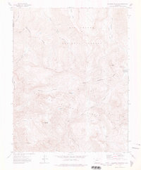
1973 Map of Palomino Mountain
USGS Topo · Published 1976About this map
The Continental Divide snake-like path through this high mountain wilderness defines the drainage patterns of the Rio Grande National Forest and San Juan National Forest. Surveyed in the early 1970s, the terrain is shaped by severe elevations where the headwaters of the Middle Fork Piedra River and East Trout Creek begin their descent. This is a landscape mapped primarily for water management and transit, as evidenced by Gaging Stations near Piedra Pass. Extensive pack trails provide the only named infrastructure through steep features like Porphyry Gulch and Dark Can, connecting remote high-altitude points such as Palomino Mountain and Sugarloaf Mountain. Isolated water bodies like Window Lake and Monument Lake highlight the high-basin topography where the Mineral County line traverses the peaks.
Find a feature on this map
28 named features on this map. Tap any name to fly to it.
Don’t see what you’re looking for? This feature index may not catch every label — zoom into the map to look around manually.
Map Details
Editions of this 1973 Palomino Mountain Map
4 editions found
Other maps of this area

1905 · San Cristobal
USGS Topo · 1:125,000

1907 · San Cristobal
USGS Topo · 1:125,000

1913 · Summitville
USGS Topo · 1:125,000

1914 · Creede
USGS Topo · 1:125,000

1915 · Summitville
USGS Topo · 1:125,000

1916 · Creede
USGS Topo · 1:125,000

1924 · Pagosa Springs
USGS Topo · 1:125,000

1927 · Pagosa Springs
USGS Topo · 1:125,000

1945 · Durango
USGS Topo · 1:250,000

1953 · Durango
USGS Topo · 1:250,000