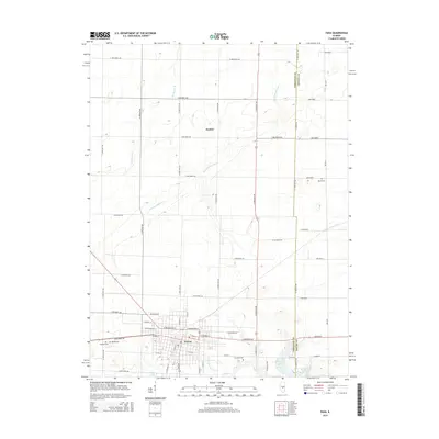
2015 Map of Pana
USGS Topo · Published 2015About this map
The southern Illinois town of Pana serves as the focal point of this survey, where the gridded streets and residential blocks give way to the agricultural landscape of Christian County and Shelby County. This area exhibits the characteristic transition from urban settlement to managed rural land, defined by a network of drainage features like the Main Drainage Ditch and Big George Br. Local genealogy is well-represented by several burial grounds situated on the outskirts of the town center, including Mound Cem, Calvary Cem, and Linwood Cem.
Find a feature on this map
59 named features on this map. Tap any name to fly to it.
Don’t see what you’re looking for? This feature index may not catch every label — zoom into the map to look around manually.
Map Details
Editions of this 2015 Pana Map
This is the sole edition of this map. No revisions or reprints were ever made.
Other maps of this area

1942 · Shelbyville
USGS Topo · 1:62,500

1946 · Shelbyville
USGS Topo · 1:62,500

1947 · Pana
USGS Topo · 1:62,500

1949 · Dalton City
USGS Topo · 1:62,500

1949 · Pana
USGS Topo · 1:62,500

1952 · Assumption
USGS Topo · 1:62,500

1958 · Decatur
USGS Topo · 1:250,000

1961 · Decatur
USGS Topo · 1:250,000

1974 · Willeys
USGS Topo · 1:24,000
1981 · Lakewood
USGS Topo · 1:24,000