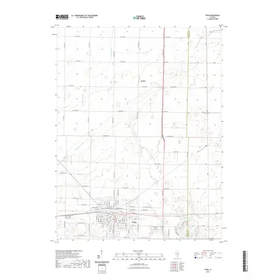
2021 Map of Pana
USGS Topo · Published 2021About this map
Pana serves as the primary urban center for this section of Central Illinois, situated at the intersection of a sprawling road network that includes Co Hwy 12 and dozens of numbered country roads. The town's layout is defined by a traditional grid, featuring prominent streets such as W Washington St and Jackson St. Outside the city limits, the landscape transitions into a meticulously surveyed agricultural plane, broken by small waterways like Coal Cr and Becks Cr.
Find a feature on this map
49 named features on this map. Tap any name to fly to it.
Don’t see what you’re looking for? This feature index may not catch every label — zoom into the map to look around manually.
Map Details
Editions of this 2021 Pana Map
This is the sole edition of this map. No revisions or reprints were ever made.
Other maps of this area

1942 · Shelbyville
USGS Topo · 1:62,500

1946 · Shelbyville
USGS Topo · 1:62,500

1947 · Pana
USGS Topo · 1:62,500

1949 · Dalton City
USGS Topo · 1:62,500

1949 · Pana
USGS Topo · 1:62,500

1952 · Assumption
USGS Topo · 1:62,500

1958 · Decatur
USGS Topo · 1:250,000

1961 · Decatur
USGS Topo · 1:250,000

1974 · Willeys
USGS Topo · 1:24,000
1981 · Lakewood
USGS Topo · 1:24,000