
1980 Map of Panguitch
USGS Topo · Published 1981About this map
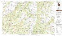
Panguitch serves as a central hub on this 1980 survey, situated where the Sevier River valley meets the rising slopes of the Paunsaugunt Plateau. The map illustrates a landscape shaped by significant geological transitions, from the sharp descent of the Hurricane Cliffs and the Pink Cliffs to the preserved expanses of Bryce Canyon National Park and Cedar Breaks National Monument. Settled areas like Paragonah and Parowan line the western edge in the Parowan Valley, while high-elevation features like Panguitch Lake and Navajo Lake indicate the region's importance for water resources and recreation. Smaller communities such as Tropic, Cannonville, and Henrieville are documented along the eastern drainage of Johns Valley, reflecting a pattern of settlement tied to narrow fertile corridors and the proximity of the Dixie National Forest.
Find a feature on this map
71 named features on this map. Tap any name to fly to it.
Don’t see what you’re looking for? This feature index may not catch every label — zoom into the map to look around manually.
Map Details
Editions of this 1980 Panguitch Map
2 editions found
Other maps of this area

1885 · St. George
USGS Topo · 1:250,000

1885 · Beaver
USGS Topo · 1:250,000

1885 · Fish Lake
USGS Topo · 1:250,000

1886 · Kanab
USGS Topo · 1:250,000

1886 · Escalante
USGS Topo · 1:250,000

1891 · St. George
USGS Topo · 1:250,000

1896 · Fish Lake
USGS Topo · 1:250,000

1950 · Enoch
USGS Topo · 1:24,000

1950 · Cedar City
USGS Topo · 1:24,000

1950 · Enoch
USGS Topo · 1:62,500