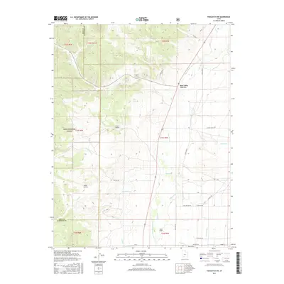
2017 Map of Panguitch NW
USGS Topo · Published 2017About this map
The Sevier River valley dominates this portion of Iron and Garfield Counties, where an intricate network of early irrigation infrastructure reflects the region's agricultural heritage. Small-scale engineering projects like the Barton Tebbs Lefevre Canal, McEwen Ditch, and Panguitch Canal reveal how water was diverted across the high desert floor to support ranching and farming operations. The terrain transitions from the river's floodplains to the wooded slopes of the Dixie National Forest in the west, with local geography marked by family-named landmarks such as Tebbs Hollow and Wide Hollow. At Bear Valley Junction, the road network connects these remote drainages. The presence of an Animal Pit near the southern edge and various named washes like Red Wash and Sand Wash further illustrate a landscape shaped by both natural erosion and specific land-use practices.
Find a feature on this map
38 named features on this map. Tap any name to fly to it.
Don’t see what you’re looking for? This feature index may not catch every label — zoom into the map to look around manually.
Map Details
Editions of this 2017 Panguitch NW Map
This is the sole edition of this map. No revisions or reprints were ever made.
Other maps of this area

1885 · Beaver
USGS Topo · 1:250,000

1886 · Kanab
USGS Topo · 1:250,000

1953 · Richfield
USGS Topo · 1:250,000

1953 · Cedar City
USGS Topo · 1:250,000

1958 · Richfield
USGS Topo · 1:250,000

1958 · Cedar City
USGS Topo · 1:250,000

1962 · Cedar City
USGS Topo · 1:250,000

1966 · Bull Rush Peak
USGS Topo · 1:24,000

1966 · Fremont Pass
USGS Topo · 1:24,000

1966 · Panguitch NW
USGS Topo · 1:24,000