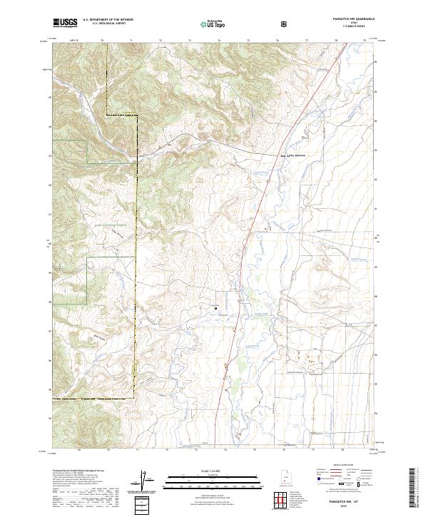
2023 Map of Panguitch NW
USGS Topo · Published 2023About this map
The Sevier River valley serves as the central corridor for this high-desert landscape, where a complex network of man-made waterways supports the region's agricultural life. Distinctive irrigation features like the Panguitch Canal, Barton Tebbs Lefevre Canal, and Marshall Ditch weave through the valley floor, indicating a highly engineered approach to water management in an arid environment. Near the intersection of these waterways, Bear Valley Junction and the Spry Cem provide localized landmarks for those researching family history in the area.
Find a feature on this map
33 named features on this map. Tap any name to fly to it.
Don’t see what you’re looking for? This feature index may not catch every label — zoom into the map to look around manually.
Map Details
Editions of this 2023 Panguitch NW Map
This is the sole edition of this map. No revisions or reprints were ever made.
Other maps of this area

1885 · Beaver
USGS Topo · 1:250,000

1886 · Kanab
USGS Topo · 1:250,000

1953 · Richfield
USGS Topo · 1:250,000

1953 · Cedar City
USGS Topo · 1:250,000

1958 · Richfield
USGS Topo · 1:250,000

1958 · Cedar City
USGS Topo · 1:250,000

1962 · Cedar City
USGS Topo · 1:250,000

1966 · Bull Rush Peak
USGS Topo · 1:24,000

1966 · Fremont Pass
USGS Topo · 1:24,000

1966 · Panguitch NW
USGS Topo · 1:24,000