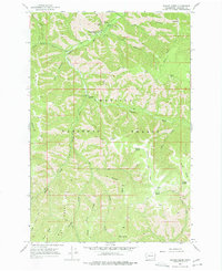
1967 Map of Panjab Creek
USGS Topo · Published 1977About this map
Umatilla National Forest dominates this landscape in Columbia County, where the north-flowing Tucannon River carves a deep valley through the northern Blue Mountains. This mid-1960s survey documents a region defined by its vital water sources and early recreational infrastructure, including Camp Wooten State Park and the Tucannon Campground. The terrain is characterized by a series of prominent ridges, such as Rattlesnake Ridge and Panjab Ridge, which separate various drainage basins. A network of Pack Trails and Jeep Trails provides the primary means of navigating the high country, connecting remote landmarks like the Indian Corral. Numerous named water sources, including Mill Canyon Spring, Alnus Spring, and Table Camp Spring, indicate the importance of reliable water for both forest management and travelers in these high elevations.
Find a feature on this map
37 named features on this map. Tap any name to fly to it.
Don’t see what you’re looking for? This feature index may not catch every label — zoom into the map to look around manually.
Map Details
Editions of this 1967 Panjab Creek Map
3 editions found
Other maps of this area

1937 · Pomeroy
USGS Topo · 1:96,000

1942 · Pomeroy
USGS Topo · 1:125,000

1955 · Pullman
USGS Topo · 1:250,000

1958 · Pullman
USGS Topo · 1:250,000

1967 · Rose Springs
USGS Topo · 1:24,000

1967 · Hopkins Ridge
USGS Topo · 1:24,000

1967 · Cahill Mtn
USGS Topo · 1:24,000

1967 · Oregon Butte
USGS Topo · 1:24,000

1967 · Stentz Spring
USGS Topo · 1:24,000
1967 · Diamond Peak
USGS Topo · 1:24,000