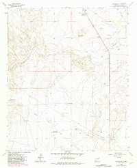
1962 Map of Panther Hill
USGS Topo · Published 1982About this map
The Dr. Robert Goddard Original Rocket Tower Site anchors the southern reaches of this Chaves County landscape, marking a significant location in early aerospace history along the banks of Middle Berrendo Creek. The terrain is defined by a network of drainage systems including Salt Creek and the Eden Valley pipeline corridor, interspersed with vital water management features such as the Butler Windmill, Panther Windmill, and Tom Ned Tank. Local community life and industrial infrastructure are represented by the Salt Creek Ch and a Compressor Station, while numerous gravel pits point to the region's extraction activities. The map reveals a transition in land use, where traditional ranching landmarks like the Toltec Recorder Well coexist with modern utility developments across the plains surrounding Panther Hill.
Find a feature on this map
16 named features on this map. Tap any name to fly to it.
Don’t see what you’re looking for? This feature index may not catch every label — zoom into the map to look around manually.
Map Details
Editions of this 1962 Panther Hill Map
2 editions found

Other maps of this area

1949 · Roswell North
USGS Topo · 1:24,000

1949 · Corn Ranch
USGS Topo · 1:24,000

1950 · Corn Ranch
USGS Topo · 1:24,000

1950 · Bitter Lake
USGS Topo · 1:24,000

1955 · Roswell
USGS Topo · 1:250,000

1958 · Roswell
USGS Topo · 1:250,000

1962 · Roswell
USGS Topo · 1:250,000
1962 · Roswell North
USGS Topo · 1:24,000

1962 · Rock House Canyon
USGS Topo · 1:24,000
1962 · Bitter Lake
USGS Topo · 1:24,000