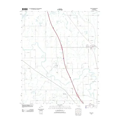
2012 Map of Paoli
USGS Topo · Published 2012About this map
The Washita River meanders across this central Oklahoma landscape, defining the topography of the region north of Pauls Valley. The settlement of Paoli sits along the eastern edge, serving as a hub for local roads like Main St and Dulin Dr. This area is characterized by a managed water system, evidenced by numerous flood control structures such as Finn Creek Site 20 Reservoir and the Wayne Creek Site 1 Reservoir.
Find a feature on this map
59 named features on this map. Tap any name to fly to it.
Don’t see what you’re looking for? This feature index may not catch every label — zoom into the map to look around manually.
Map Details
Editions of this 2012 Paoli Map
This is the sole edition of this map. No revisions or reprints were ever made.
Other maps of this area

1898 · Pauls Valley
USGS Topo · 1:125,000

1902 · Pauls Valley
USGS Topo · 1:125,000

1957 · Ardmore
USGS Topo · 1:250,000

1963 · Ardmore
USGS Topo · 1:250,000
1965 · Rosedale
USGS Topo · 1:24,000

1965 · Byars SW
USGS Topo · 1:24,000
1965 · Wayne
USGS Topo · 1:24,000

1965 · Pauls Valley
USGS Topo · 1:24,000

1965 · Maysville
USGS Topo · 1:24,000

1965 · Paoli
USGS Topo · 1:24,000