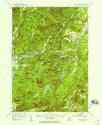
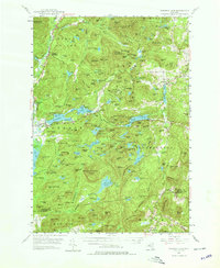
1953 Map of Paradox Lake
USGS Topo · Published 1958About this map
Paradox Lake anchors this mid-century topographic survey of the Adirondack foothills, where a network of waterways including the Schroon River and Sucker Hole Creek defined the local settlement patterns. Small communities like Ironville and Chilson are shown alongside vestiges of the region's industrial past, notably at Railroad Hill and the Inactive Mines near Furnace Mtn. The terrain is characterized by a dense concentration of named peaks and ridges, such as Skiff Mountain and Nippletop Mountain, many of which were likely critical for fire observation as evidenced by the Lookout Tower on Pharaoh Mountain.
Find a feature on this map
198 named features on this map. Tap any name to fly to it.
Don’t see what you’re looking for? This feature index may not catch every label — zoom into the map to look around manually.
Map Details
Editions of this 1953 Paradox Lake Map
5 editions found
Other maps of this area

1893 · Whitehall
USGS Topo · 1:62,500

1894 · Elizabethtown
USGS Topo · 1:62,500

1894 · Port Henry
USGS Topo · 1:62,500

1894 · Ticonderoga
USGS Topo · 1:62,500

1895 · Whitehall
USGS Topo · 1:62,500

1895 · Elizabethtown
USGS Topo · 1:62,500

1895 · North Creek
USGS Topo · 1:62,500

1895 · Mt. Marcy
USGS Topo · 1:62,500

1895 · Paradox Lake
USGS Topo · 1:62,500

1896 · Ticonderoga
USGS Topo · 1:62,500