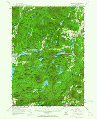
1953 Map of Paradox Lake
USGS Topo · Published 1964About this map
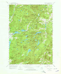
The eastern Adirondack wilderness of Essex Co is defined by a dense network of water bodies and peaks as it appeared in the mid-1950s. Paradox Lake and Eagle Lake dominate the central landscape, while the southern reaches feature the high elevation of Pharaoh Mountain topped with a Lookout Tower. Small settlements like Ironville, Chilson, and the hamlet of Paradox are connected by the early alignments of N.Y. 9 and N.Y. 73, alongside the industrial presence of a Sawmill and numerous Inactive Mines. Local religious life is anchored by St Nicholas Chapel and the Antwine Chapel, tucked away near Crane Pond. The map reveals a land utilized for both its natural resources and remote character, from the Graphite district in the south to the quiet reaches of Little Canada and the Desolate Swamp.
Find a feature on this map
202 named features on this map. Tap any name to fly to it.
Don’t see what you’re looking for? This feature index may not catch every label — zoom into the map to look around manually.
Map Details
Editions of this 1953 Paradox Lake Map
5 editions found
Other maps of this area

1893 · Whitehall
USGS Topo · 1:62,500

1894 · Elizabethtown
USGS Topo · 1:62,500

1894 · Port Henry
USGS Topo · 1:62,500

1894 · Ticonderoga
USGS Topo · 1:62,500

1895 · Whitehall
USGS Topo · 1:62,500

1895 · Elizabethtown
USGS Topo · 1:62,500

1895 · North Creek
USGS Topo · 1:62,500

1895 · Mt. Marcy
USGS Topo · 1:62,500

1895 · Paradox Lake
USGS Topo · 1:62,500

1896 · Ticonderoga
USGS Topo · 1:62,500