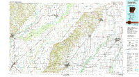
1984 Map of Paragould
USGS Topo · Published 1990About this map
Crowleys Ridge rises dramatically above the alluvial plains of the Mississippi Embayment, serving as the central geographic anchor for this 1980s landscape. This topographical study captures the unique hydrology of Northeast Arkansas and Southeast Missouri, where the St. Francis River and Black River flank the ridge. The map reveals a complex network of drainage ditches, such as Ditch No 6 and Middle Ditch, which transformed former wetlands into the productive agricultural zones surrounding Paragould and Corning.
Find a feature on this map
162 named features on this map. Tap any name to fly to it.
Don’t see what you’re looking for? This feature index may not catch every label — zoom into the map to look around manually.
Map Details
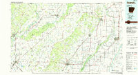
Editions of this 1984 Paragould Map
2 editions found
Other maps of this area

1932 · Walnut Ridge
USGS Topo · 1:62,500

1934 · Kennett
USGS Topo · 1:62,500

1934 · Powhatan
USGS Topo · 1:62,500

1935 · Powhatan
USGS Topo · 1:62,500

1935 · Acorn
USGS Topo · 1:62,500

1935 · Sedgwick
USGS Topo · 1:62,500

1935 · Alicia
USGS Topo · 1:62,500

1935 · Rector
USGS Topo · 1:62,500

1935 · Knobel
USGS Topo · 1:62,500

1935 · Reyno
USGS Topo · 1:62,500