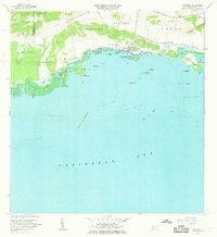
1966 Map of Parguera
USGS Topo · Published 1969About this map
The coastal settlement of Parguera serves as the focal point for this mid-1960s study of the southwestern Puerto Rican shoreline. This period reveals a landscape transitioning from rural holdings like Rancho Cabassa to a center for scientific research, anchored by the Universidad de Puerto Rico (Instituto Biología Marina) on Isla Magueyes and a nearby NIH Research Facility. The survey provides an exceptionally detailed look at the marine environment, mapping the intricate coral reef systems including Arrecife Media Luna and Arrecife Coral that buffer the coast.
Find a feature on this map
52 named features on this map. Tap any name to fly to it.
Don’t see what you’re looking for? This feature index may not catch every label — zoom into the map to look around manually.
Map Details
Editions of this 1966 Parguera Map
2 editions found
Other maps of this area

1935 · Puerto Real
USGS Topo · 1:25,000

1937 · San German
USGS Topo · 1:25,000

1937 · Sabana Grande
USGS Topo · 1:25,000

1937 · Puerto Real
USGS Topo · 1:25,000

1938 · Guanica
USGS Topo · 1:30,000

1938 · Parguera
USGS Topo · 1:30,000

1938 · Cabo Rojo
USGS Topo · 1:30,000

1941 · San German
USGS Topo · 1:30,000

1941 · Puerto Real
USGS Topo · 1:30,000

1941 · Sabana Grande
USGS Topo · 1:30,000