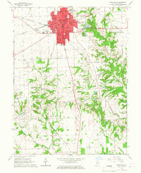
1966 Map of Paris South
USGS Topo · Published 1967About this map
Paris serves as the central hub of this 1960s study, showcasing a dense grid of civic and educational life centered on the Courthouse and Po. The city is surrounded by an extensive network of small schools such as Vance Sch, Tanner Sch, and Mayo Sch, reflecting the organized rural community structure of Edgar County. A notable historical artifact is the Old Indian Treaty Boundary, which cuts across the landscape south of the city, marking a significant early territorial line that still influenced land divisions during this era.
Find a feature on this map
41 named features on this map. Tap any name to fly to it.
Don’t see what you’re looking for? This feature index may not catch every label — zoom into the map to look around manually.
Map Details
Editions of this 1966 Paris South Map
2 editions found
Other maps of this area

1932 · Marshall
USGS Topo · 1:62,500

1936 · Casey
USGS Topo · 1:48,000

1937 · Marshall
USGS Topo · 1:62,500

1942 · Dennison
USGS Topo · 1:24,000

1942 · Casey
USGS Topo · 1:62,500

1943 · Casey
USGS Topo · 1:62,500

1946 · Kansas
USGS Topo · 1:62,500

1947 · Paris
USGS Topo · 1:62,500

1949 · Kansas
USGS Topo · 1:62,500

1949 · Paris
USGS Topo · 1:62,500