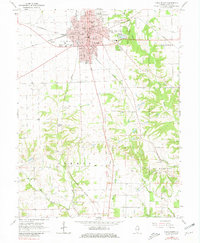
1966 Map of Paris South
USGS Topo · Published 1981About this map
The city of Paris serves as the focal point for this 1966 survey, showing the expansion of the county seat southward through local landmarks like Sylvan Park and the Elks Country Club. The map captures a transition from the urban grid, anchored by the Courthouse and Crawford Hospital, into the rolling farmland of Stratton and Symmes. This rural landscape is deeply marked by lineage and early settlement history, evidenced by an exceptional density of family burial grounds including Cassady Cem, Ford Lycan Cem, and Elledge Holley Cem.
Find a feature on this map
45 named features on this map. Tap any name to fly to it.
Don’t see what you’re looking for? This feature index may not catch every label — zoom into the map to look around manually.
Map Details
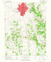
Editions of this 1966 Paris South Map
2 editions found
Other maps of this area

1932 · Marshall
USGS Topo · 1:62,500

1936 · Casey
USGS Topo · 1:48,000

1937 · Marshall
USGS Topo · 1:62,500

1942 · Dennison
USGS Topo · 1:24,000

1942 · Casey
USGS Topo · 1:62,500

1943 · Casey
USGS Topo · 1:62,500

1946 · Kansas
USGS Topo · 1:62,500

1947 · Paris
USGS Topo · 1:62,500

1949 · Kansas
USGS Topo · 1:62,500

1949 · Paris
USGS Topo · 1:62,500