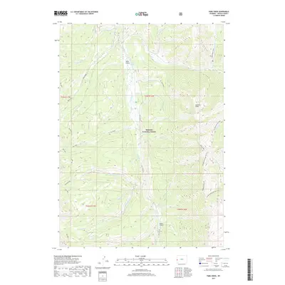
2017 Map of Park Creek
USGS Topo · Published 2017About this map
The Wyoming Range dominates this portion of the Bridger National Forest, where high-altitude drainage systems feed into the Greys River. This 2017 topographic survey highlights a landscape defined by its complex hydrology, featuring the confluence of N Three Forks Cr, Middle Three Forks Cr, and S Three Forks Cr. These waters carve through dramatic landforms like Broad Canyon and Young Canyon, the latter of which is home to Young Spring. For researchers, the map provides a contemporary record of forest access and recreation, documenting the Greys River Rd and the extensive path of the Wy Range Nat Rec Trail. Dozens of smaller tributaries, including Upper Cabin Cr and S Cottonwood Cr, illustrate the intricate watershed patterns that have shaped this high-country environment for centuries.
Find a feature on this map
39 named features on this map. Tap any name to fly to it.
Don’t see what you’re looking for? This feature index may not catch every label — zoom into the map to look around manually.
Map Details
Editions of this 2017 Park Creek Map
This is the sole edition of this map. No revisions or reprints were ever made.
Other maps of this area

1921 · Afton
USGS Topo · 1:125,000

1955 · Preston
USGS Topo · 1:250,000

1958 · Preston
USGS Topo · 1:250,000

1962 · Preston
USGS Topo · 1:250,000
1980 · Blind Bull Creek
USGS Topo · 1:24,000
1980 · Triple Peak
USGS Topo · 1:24,000
1980 · Man Peak
USGS Topo · 1:24,000
1980 · Mount Schidler
USGS Topo · 1:24,000
1980 · Box Canyon Creek
USGS Topo · 1:24,000
1980 · Red Top Mountain
USGS Topo · 1:24,000