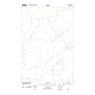
2011 Map of Park
USGS Topo · Published 2011About this map
Park and Linden are primary points of settlement in this northern Idaho landscape, where the terrain is defined by a dense network of high ridges and deep drainages. The geography is characterized by the prominent Tamarack Ridge and Cedar Ridge, which separate various watersheds. Moving through these elevations, several named creeks including Boulder Creek, Leopold Creek, and Rock Creek create a complex hydrologic pattern that likely dictated early routes and homestead locations.
Find a feature on this map
29 named features on this map. Tap any name to fly to it.
Don’t see what you’re looking for? This feature index may not catch every label — zoom into the map to look around manually.
Map Details
Editions of this 2011 Park Map
This is the sole edition of this map. No revisions or reprints were ever made.
Other maps of this area

1955 · Pullman
USGS Topo · 1:250,000

1958 · Pullman
USGS Topo · 1:250,000

1961 · Deary
USGS Topo · 1:62,500

1961 · Kendrick
USGS Topo · 1:62,500

1961 · Ahsahka
USGS Topo · 1:62,500

1961 · Bovill
USGS Topo · 1:62,500

1981 · Potlatch
USGS Topo · 1:100,000
1990 · Ahsahka
USGS Topo · 1:24,000
1990 · Lenore
USGS Topo · 1:24,000
1990 · Mc Gary Butte
USGS Topo · 1:24,000