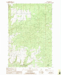
1990 Map of Park
USGS Topo · Published 1991About this map
The small settlement of Park occupies a high plateau in Latah County, situated along the Boise Meridian where the timbered ridges of northern Idaho begin their descent toward the Clearwater River. This 1990 survey, based on field work from the late 1980s, documents a landscape defined by steep drainage systems like Three Bear Creek and Chambers Creek that cut through the surrounding highlands. The proximity of the Clearwater County line and Nez Perce County border to the south highlights the map's position at a critical geographic junction. Local infrastructure is sparse but functional, featuring a Landing Strip and a Windmill near the townsite, alongside a Gravel Pit and a Transmission Line that cut across the ridge tops. Prominent terrain features such as Norwegian Ridge and Cedar Ridge dominate the southern half of the sheet, providing a clear view of the topographical challenges faced by early settlers in this pocket of the Idaho Panhandle.
Find a feature on this map
25 named features on this map. Tap any name to fly to it.
Don’t see what you’re looking for? This feature index may not catch every label — zoom into the map to look around manually.
Map Details
Editions of this 1990 Park Map
This is the sole edition of this map. No revisions or reprints were ever made.
Other maps of this area

1955 · Pullman
USGS Topo · 1:250,000

1958 · Pullman
USGS Topo · 1:250,000

1961 · Deary
USGS Topo · 1:62,500

1961 · Kendrick
USGS Topo · 1:62,500

1961 · Ahsahka
USGS Topo · 1:62,500

1961 · Bovill
USGS Topo · 1:62,500

1981 · Potlatch
USGS Topo · 1:100,000
1990 · Ahsahka
USGS Topo · 1:24,000
1990 · Lenore
USGS Topo · 1:24,000
1990 · Mc Gary Butte
USGS Topo · 1:24,000