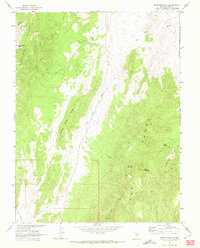
1968 Map of Park Mountain
USGS Topo · Published 1972About this map
Park Mountain and the high ridges of the Park Range dominate this landscape in Nye County, Nevada, as it appeared during a 1968 field check. The topography is defined by the convergence of major upland features, including Moonshine Peak in the northwest and the prominent Crested Wheat Ridge that runs through the center of the sheet. Water sources, critical in this arid high-desert environment, are clearly marked at Cottonwood Springs, Tank Spring, and along Moonshine Creek.
Find a feature on this map
16 named features on this map. Tap any name to fly to it.
Don’t see what you’re looking for? This feature index may not catch every label — zoom into the map to look around manually.
Map Details
Editions of this 1968 Park Mountain Map
2 editions found
Other maps of this area

1926 · Roberts Mountains
USGS Topo · 1:250,000

1929 · Roberts Mountains
USGS Topo · 1:250,000

1955 · Millett
USGS Topo · 1:250,000

1956 · Cockalorum Wash
USGS Topo · 1:62,500

1956 · Horse Heaven Mtn
USGS Topo · 1:62,500

1956 · Tonopah
USGS Topo · 1:250,000

1959 · Tonopah
USGS Topo · 1:250,000

1959 · Millett
USGS Topo · 1:250,000

1962 · Tonopah
USGS Topo · 1:250,000

1968 · Pritchards Station
USGS Topo · 1:62,500