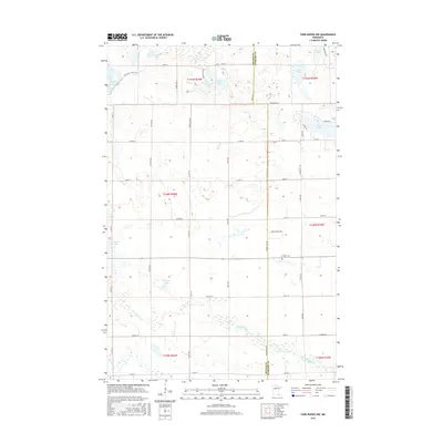
2016 Map of Park Rapids NW
USGS Topo · Published 2016About this map
The Straight River and Shell River drain this glacial landscape along the border of Becker and Hubbard Counties. The area is defined by its high density of small, distinct water bodies, ranging from the singular One Acre Lake to the larger Straight Lake and Portage Lake. This 2016 survey illustrates the persistent rural character of the region, where a grid of secondary roads like Witter Ave and Brill Ave connects scattered homesteads and woodland tracts. The presence of Crandall Cem south of Edgewood Loop provides a specific point of interest for genealogists tracing local families in the northwestern townships. Significant local landmarks include Knights Lake, Valines Lake, and the aptly named Fools Lake, each surrounded by the undulating terrain typical of this part of Minnesota. The map reflects a landscape dedicated to timber and small-scale agriculture, remaining largely unchanged in its fundamental layout for decades.
Find a feature on this map
55 named features on this map. Tap any name to fly to it.
Don’t see what you’re looking for? This feature index may not catch every label — zoom into the map to look around manually.
Map Details
Editions of this 2016 Park Rapids NW Map
This is the sole edition of this map. No revisions or reprints were ever made.
Other maps of this area

1953 · Brainerd
USGS Topo · 1:250,000

1954 · Bemidji
USGS Topo · 1:250,000

1957 · Brainerd
USGS Topo · 1:250,000

1957 · Bemidji
USGS Topo · 1:250,000

1958 · Bemidji
USGS Topo · 1:250,000

1958 · Brainerd
USGS Topo · 1:250,000

1965 · Brainerd
USGS Topo · 1:250,000

1969 · Wolf Lake
USGS Topo · 1:24,000

1969 · Park Rapids
USGS Topo · 1:24,000

1969 · Menahga
USGS Topo · 1:24,000