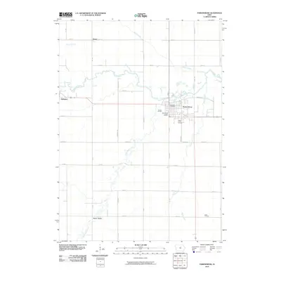
2010 Map of Parkersburg
USGS Topo · Published 2010About this map
Beaver Creek and its various tributaries, including Kilsons Branch and Johnson Creek, define the drainage of this Butler County landscape. The settlement of Parkersburg serves as the primary hub, with its grid extending south toward the Parker Burial Grounds and west toward Oak Hill Cemetery. The infrastructure of the era is anchored by Railroad ST and the Parkersburg Post Office, reflecting a community connected by both rail and road.
Find a feature on this map
40 named features on this map. Tap any name to fly to it.
Don’t see what you’re looking for? This feature index may not catch every label — zoom into the map to look around manually.
Map Details
Editions of this 2010 Parkersburg Map
This is the sole edition of this map. No revisions or reprints were ever made.
Other maps of this area

1954 · Waterloo
USGS Topo · 1:250,000

1955 · Waterloo
USGS Topo · 1:250,000

1971 · Dike
USGS Topo · 1:24,000

1971 · Coster
USGS Topo · 1:24,000

1971 · Stout
USGS Topo · 1:24,000

1979 · Holland
USGS Topo · 1:24,000

1979 · Dumont South
USGS Topo · 1:24,000

1979 · Butler Center
USGS Topo · 1:24,000

1980 · Aplington
USGS Topo · 1:24,000

1980 · Wellsburg
USGS Topo · 1:24,000