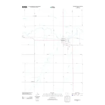
2013 Map of Parkersburg
USGS Topo · Published 2013About this map
Parkersburg sits as the central hub of this Iowa landscape, where the local street grid is bounded by the winding course of Beaver Cr and Phelps Cr. The township layout is defined by a rigorous network of section roads like Ivy Ave and 300th St, which connect the main town to smaller outlying locales including Eleanor to the north and Buck Grove to the southwest. The presence of Railroad St running east-west through the heart of Parkersburg points to the area's enduring reliance on rail transport for its agricultural economy.
Find a feature on this map
47 named features on this map. Tap any name to fly to it.
Don’t see what you’re looking for? This feature index may not catch every label — zoom into the map to look around manually.
Map Details
Editions of this 2013 Parkersburg Map
This is the sole edition of this map. No revisions or reprints were ever made.
Other maps of this area

1954 · Waterloo
USGS Topo · 1:250,000

1955 · Waterloo
USGS Topo · 1:250,000

1971 · Dike
USGS Topo · 1:24,000

1971 · Coster
USGS Topo · 1:24,000

1971 · Stout
USGS Topo · 1:24,000

1979 · Holland
USGS Topo · 1:24,000

1979 · Dumont South
USGS Topo · 1:24,000

1979 · Butler Center
USGS Topo · 1:24,000

1980 · Aplington
USGS Topo · 1:24,000

1980 · Wellsburg
USGS Topo · 1:24,000