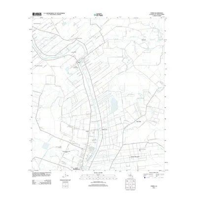
2012 Map of Parks
USGS Topo · Published 2012About this map
Bayou Teche winds through this Saint Martin Parish landscape, serving as the central geographic feature for settlements like Parks and Saint John. The terrain is defined by a dense network of coulees and canals, including Cypress Island Coulee and Catahoula Coulee, which manage the water levels of the low-lying basin. Agricultural land patterns are interspersed with evidence of the region's energy economy, most notably at the Section 28 Oil and Gas Field and the Saint Martinville Oil and Gas Field. Small aviation outposts like Castille Field Airport and the Gary Landing Strip dot the area north of Saint Martinville. Toward the east, the map captures more rural reaches near Isle Labbe and Banker Plantation, where the land transitions into the marshy complex surrounding Bayou Martin.
Find a feature on this map
118 named features on this map. Tap any name to fly to it.
Don’t see what you’re looking for? This feature index may not catch every label — zoom into the map to look around manually.
Map Details
Editions of this 2012 Parks Map
This is the sole edition of this map. No revisions or reprints were ever made.
Other maps of this area

1935 · Osca Bayou
USGS Topo · 1:62,500

1939 · St. Martinsville
USGS Topo · 1:62,500

1940 · Arnaudville
USGS Topo · 1:62,500

1941 · Loreauville
USGS Topo · 1:62,500

1954 · Loreauville
USGS Topo · 1:62,500

1954 · Baton Rouge
USGS Topo · 1:250,000

1955 · Osca Bayou
USGS Topo · 1:62,500

1956 · Baton Rouge
USGS Topo · 1:250,000

1957 · St. Martinville
USGS Topo · 1:62,500
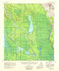
1959 · Osca Bayou
USGS Topo · 1:62,500