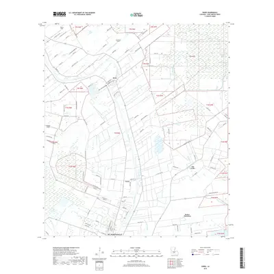
2018 Map of Parks
USGS Topo · Published 2018About this map
Bayou Teche defines the central corridor of this Saint Martin Parish landscape, winding through a region characterized by its intricate drainage networks and deep agricultural roots. The settlement of Parks serves as a local hub along the bayou, while to the south, the map captures the northern edge of St. Martinville. The land is divided into numerous coulees and bayous, such as Catahoula Coulee, Pointe Claire Coulee, and Bayou Martin, which drain the low-lying plains between elevated areas like Cypress Island. This 2018 survey reveals a mosaic of modern property divisions and historic land use, including Banker Plantation and the community of Levert. Local aviation is represented by the Ace Flying Airport and Castille Field, providing a look at how contemporary infrastructure sits alongside traditional water-dependent settlements and the natural wetlands of the Atchafalaya basin periphery.
Find a feature on this map
97 named features on this map. Tap any name to fly to it.
Don’t see what you’re looking for? This feature index may not catch every label — zoom into the map to look around manually.
Map Details
Editions of this 2018 Parks Map
This is the sole edition of this map. No revisions or reprints were ever made.
Other maps of this area

1935 · Osca Bayou
USGS Topo · 1:62,500

1939 · St. Martinsville
USGS Topo · 1:62,500

1940 · Arnaudville
USGS Topo · 1:62,500

1941 · Loreauville
USGS Topo · 1:62,500

1954 · Loreauville
USGS Topo · 1:62,500

1954 · Baton Rouge
USGS Topo · 1:250,000

1955 · Osca Bayou
USGS Topo · 1:62,500

1956 · Baton Rouge
USGS Topo · 1:250,000

1957 · St. Martinville
USGS Topo · 1:62,500
1959 · Osca Bayou
USGS Topo · 1:62,500