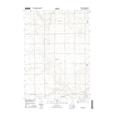
2015 Map of Parkston SE
USGS Topo · Published 2015About this map
The agricultural grid of Hutchinson County is meticulously defined by a network of local roads including 279th St and 418th Ave. This landscape is marked by the presence of several German-Russian heritage cemeteries, such as Drei Creek Cem and Hoffnungstahl Cem, which offer significant data points for genealogists tracing early prairie families. These sites are often found near the undulating drainage of Lonetree Cr or the branches of Dry Cr, where the terrain begins to break the strict geometry of the section lines. The distribution of Kulm Cem, Friedenfeld Cem, and Bethel Cem across the township suggests the former locations of rural church communities that once anchored the social life of the region's farming population during the late nineteenth and early twentieth centuries.
Find a feature on this map
30 named features on this map. Tap any name to fly to it.
Don’t see what you’re looking for? This feature index may not catch every label — zoom into the map to look around manually.
Map Details
Editions of this 2015 Parkston SE Map
This is the sole edition of this map. No revisions or reprints were ever made.
Other maps of this area

1898 · Olivet
USGS Topo · 1:125,000

1955 · Sioux Falls
USGS Topo · 1:250,000

1957 · Tschetter Colony
USGS Topo · 1:24,000

1957 · Milltown
USGS Topo · 1:24,000

1957 · Clayton
USGS Topo · 1:24,000

1957 · Scotland
USGS Topo · 1:24,000

1958 · Sioux Falls
USGS Topo · 1:250,000
1978 · Kaylor
USGS Topo · 1:24,000
1978 · Tripp
USGS Topo · 1:24,000
1980 · Parkston SE
USGS Topo · 1:24,000