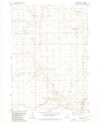
1980 Map of Parkston SE
USGS Topo · Published 1980About this map
Drei Creek Cem and Kulm Sch stand as enduring landmarks in this rural landscape within Milltown and Sharon townships. The map illustrates a strictly sectioned agricultural region where cultural life centered on small, family-linked burial grounds such as Friedenfeld Cem, Bethel Cem, and Hoffnungstahl Cem. These sites, often positioned near section corners, underscore the importance of local heritage in Hutchinson County during the late twentieth century.
Find a feature on this map
21 named features on this map. Tap any name to fly to it.
Don’t see what you’re looking for? This feature index may not catch every label — zoom into the map to look around manually.
Map Details
Editions of this 1980 Parkston SE Map
This is the sole edition of this map. No revisions or reprints were ever made.
Other maps of this area

1898 · Olivet
USGS Topo · 1:125,000

1955 · Sioux Falls
USGS Topo · 1:250,000

1957 · Tschetter Colony
USGS Topo · 1:24,000

1957 · Milltown
USGS Topo · 1:24,000

1957 · Clayton
USGS Topo · 1:24,000

1957 · Scotland
USGS Topo · 1:24,000

1958 · Sioux Falls
USGS Topo · 1:250,000
1978 · Kaylor
USGS Topo · 1:24,000
1978 · Tripp
USGS Topo · 1:24,000
1980 · Beardsley
USGS Topo · 1:24,000
Featured Places
- Wittenberg Township, SD
- Milltown Township, SD
- Capital Township, SD
- German Township, SD
- Kaylor Township, SD