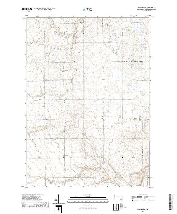
2021 Map of Parkston SE
USGS Topo · Published 2021About this map
Lonetree Creek and the various forks of Dry Creek define the agricultural landscape of southeastern Hutchinson County in this modern survey. The map area is characterized by a dense grid of rural roads and numerous small family or community cemeteries, which offer valuable points of interest for genealogists and local historians. These burial sites, including Drei Creek Cemetery and Friedenfeld Cemetery, are dispersed across the sections, often located near the intermittent drainages like North Branch Dry Creek. The layout of the land reflects a traditional Midwestern section-line road network, where thoroughfares such as 419th Avenue and 281st Street provide access to the isolated farmsteads and rural landmarks like Hoffnungstahl Cemetery and Bethel 2 Cemetery.
Find a feature on this map
31 named features on this map. Tap any name to fly to it.
Don’t see what you’re looking for? This feature index may not catch every label — zoom into the map to look around manually.
Map Details
Editions of this 2021 Parkston SE Map
This is the sole edition of this map. No revisions or reprints were ever made.
Other maps of this area

1898 · Olivet
USGS Topo · 1:125,000

1955 · Sioux Falls
USGS Topo · 1:250,000

1957 · Tschetter Colony
USGS Topo · 1:24,000

1957 · Milltown
USGS Topo · 1:24,000

1957 · Clayton
USGS Topo · 1:24,000

1957 · Scotland
USGS Topo · 1:24,000

1958 · Sioux Falls
USGS Topo · 1:250,000
1978 · Kaylor
USGS Topo · 1:24,000
1978 · Tripp
USGS Topo · 1:24,000
1980 · Parkston SE
USGS Topo · 1:24,000
Featured Places
- Wittenberg Township, SD
- Capital Township, SD
- Kaylor Township, SD
- Milltown Township, SD
- Sharon Township, SD