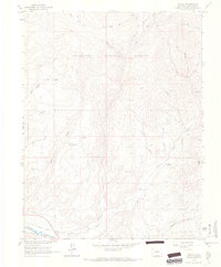
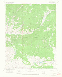
1964 Map of Parlin
USGS Topo · Published 1967About this map
Parlin serves as the focal point of this mid-1960s landscape, situated at the confluence of Tomichi Creek and Quartz Creek. The region reflects a transition from valley floor agriculture, evidenced by several unnamed ditches and the Big Seep Reservoir, to the high-elevation mining and timber resources of the Gunnison National Forest. Transport history is clearly etched into the terrain via the Old Railroad Grade and Railroad Grade following the creek paths, alongside a network of rugged routes like the Pack Trail and Jeep Trail. Prospectors were active throughout the northern gulches, with specific operations such as the Willow Creek Mine and Brown Derby Mine marking the industrial footprint. Topographic highlights include the high elevations of Fossil Ridge and the broad Roundup Basin, illustrating the complex drainage systems of Alder Creek and Beaver Creek.
Find a feature on this map
41 named features on this map. Tap any name to fly to it.
Don’t see what you’re looking for? This feature index may not catch every label — zoom into the map to look around manually.
Map Details
Editions of this 1964 Parlin Map
3 editions found
Other maps of this area

1941 · Pitkin
USGS Topo · 1:62,500

1945 · Pitkin
USGS Topo · 1:62,500

1956 · Montrose
USGS Topo · 1:250,000

1959 · Montrose
USGS Topo · 1:250,000

1960 · Montrose
USGS Topo · 1:250,000

1962 · Doyleville
USGS Topo · 1:24,000

1962 · Iris
USGS Topo · 1:24,000

1962 · Houston Gulch
USGS Topo · 1:24,000
1964 · Signal Peak
USGS Topo · 1:24,000
1964 · Pitkin
USGS Topo · 1:24,000