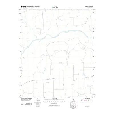
2010 Map of Parnell
USGS Topo · Published 2010About this map
The Prairie Dog Town Fork Red River flows across this Hall County landscape, joined by the Little Red River and Indian Creek in an area characterized by wide riverbeds and shifting watercourses. Near the western edge, Goat Island sits within the main river fork, while the small rural settlements of Parnell and Hulver anchor the local road network. The map detail reflects a traditional West Texas ranching and farming layout, dominated by a grid of county roads such as Co RD 24 and Co RD K that connect isolated homesteads to the primary thoroughfares. For those looking into local genealogy, the Hulver Cemetery serves as a significant landmark in the southern portion of the quadrangle, situated near the headwaters of Mountain Creek.
Find a feature on this map
20 named features on this map. Tap any name to fly to it.
Don’t see what you’re looking for? This feature index may not catch every label — zoom into the map to look around manually.
Map Details
Editions of this 2010 Parnell Map
This is the sole edition of this map. No revisions or reprints were ever made.
Other maps of this area

1954 · Plainview
USGS Topo · 1:250,000

1958 · Plainview
USGS Topo · 1:250,000

1961 · Memphis
USGS Topo · 1:62,500

1961 · Estelline
USGS Topo · 1:62,500

1967 · Tell North
USGS Topo · 1:24,000

1967 · Badger Nest Tank
USGS Topo · 1:24,000

1967 · Blue Tank Canyon
USGS Topo · 1:24,000

1976 · Memphis NW
USGS Topo · 1:24,000

1976 · Memphis SE
USGS Topo · 1:24,000

1976 · Memphis NE
USGS Topo · 1:24,000