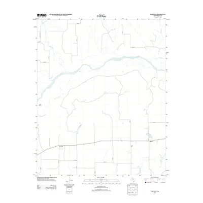
2013 Map of Parnell
USGS Topo · Published 2013About this map
Parnell and Hulver are the primary settlements in this rural corner of Hall County, where the landscape is defined by the braided channels of the Prairie Dog Town Fork Red River. The map reveals a highly structured grid of section roads, including Co Road O and Co Road Q, that overlay the natural drainage patterns of Indian Cr and Parker Cr. Genealogists and local historians can locate the Hulver Cem situated south of the main river fork. The terrain features a significant separation between the main river and the Little Red River to the south, with Goat Island appearing as a notable landmark within the northern waterway. This survey captures the region's agricultural layout and the vital water sources that dictate the placement of local homesteads and travel routes.
Find a feature on this map
24 named features on this map. Tap any name to fly to it.
Don’t see what you’re looking for? This feature index may not catch every label — zoom into the map to look around manually.
Map Details
Editions of this 2013 Parnell Map
This is the sole edition of this map. No revisions or reprints were ever made.
Other maps of this area

1954 · Plainview
USGS Topo · 1:250,000

1958 · Plainview
USGS Topo · 1:250,000

1961 · Memphis
USGS Topo · 1:62,500

1961 · Estelline
USGS Topo · 1:62,500

1967 · Tell North
USGS Topo · 1:24,000

1967 · Badger Nest Tank
USGS Topo · 1:24,000

1967 · Blue Tank Canyon
USGS Topo · 1:24,000

1976 · Memphis NW
USGS Topo · 1:24,000

1976 · Memphis SE
USGS Topo · 1:24,000

1976 · Memphis NE
USGS Topo · 1:24,000