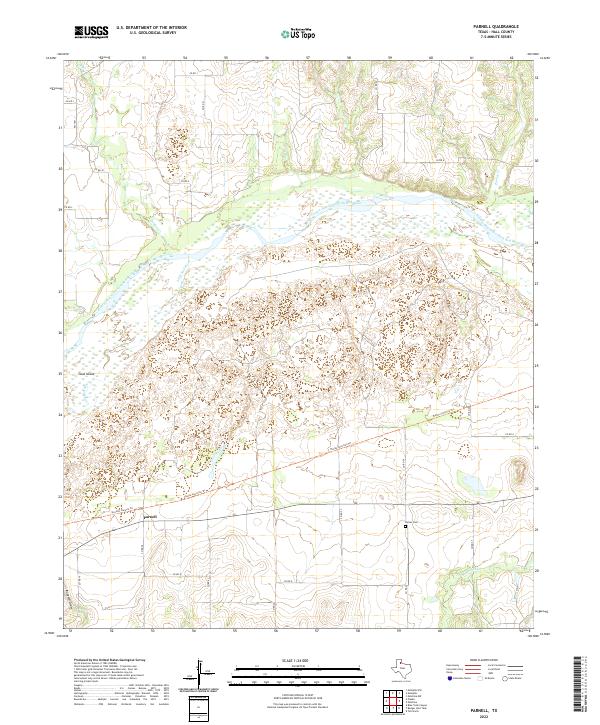
2022 Map of Parnell
USGS Topo · Published 2022About this map
Parnell anchors this portion of Hall County, situated where the high plains break toward the complex drainage system of the Red River. The landscape is defined by the broad, braided channel of the Prairie Dog Town Fork Red River, which is joined here by the Little Red River. This confluence creates a labyrinth of shifting sands and seasonal watercourses, including the notable Goat Island positioned within the main riverbed. Local travel is marked by a mix of established county roads and specialized pathways like the Plains Junction Trl and Grundy Canyon Trl, which navigate the elevation changes between the flat tablelands and the eroded breaks. Genealogists and local historians will find the Hulver Cem located south of the main river fork, providing a specific point of reference for the families who settled this challenging cattle-country terrain.
Find a feature on this map
25 named features on this map. Tap any name to fly to it.
Don’t see what you’re looking for? This feature index may not catch every label — zoom into the map to look around manually.
Map Details
Editions of this 2022 Parnell Map
This is the sole edition of this map. No revisions or reprints were ever made.
Other maps of this area

1954 · Plainview
USGS Topo · 1:250,000

1958 · Plainview
USGS Topo · 1:250,000

1961 · Memphis
USGS Topo · 1:62,500

1961 · Estelline
USGS Topo · 1:62,500

1967 · Tell North
USGS Topo · 1:24,000

1967 · Badger Nest Tank
USGS Topo · 1:24,000

1967 · Blue Tank Canyon
USGS Topo · 1:24,000

1976 · Memphis NW
USGS Topo · 1:24,000

1976 · Memphis SE
USGS Topo · 1:24,000

1976 · Memphis NE
USGS Topo · 1:24,000