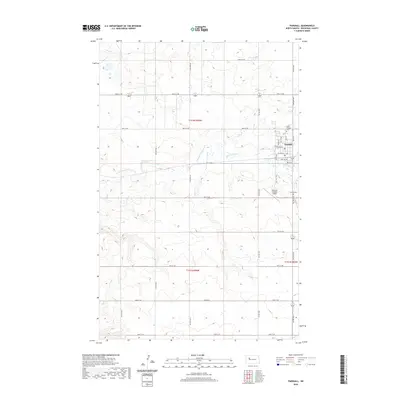
2020 Map of Parshall
USGS Topo · Published 2020About this map
Parshall serves as the central hub of this North Dakota landscape, organized by a precise grid of county roads and section lines typical of the Great Plains. The settlement is anchored by a local Post Office and is bordered to the north by Saint Bridgets Cem, while the Parshall Cem lies just south of the town center. The surrounding terrain is defined by the winding paths of Shell Creek and its tributary, E Fork Shell Creek, which carve subtle drainage patterns through the agricultural sections.
Find a feature on this map
34 named features on this map. Tap any name to fly to it.
Don’t see what you’re looking for? This feature index may not catch every label — zoom into the map to look around manually.
Map Details
Editions of this 2020 Parshall Map
This is the sole edition of this map. No revisions or reprints were ever made.
Other maps of this area

1953 · Williston
USGS Topo · 1:250,000

1953 · Watford City
USGS Topo · 1:250,000

1957 · Williston
USGS Topo · 1:250,000

1957 · Watford City
USGS Topo · 1:250,000

1967 · Watford City
USGS Topo · 1:250,000
1967 · Parshall SE
USGS Topo · 1:24,000

1967 · Parshall SW
USGS Topo · 1:24,000

1967 · New Town SE
USGS Topo · 1:24,000
1981 · Parshall NE
USGS Topo · 1:24,000
1981 · Epworth SE
USGS Topo · 1:24,000