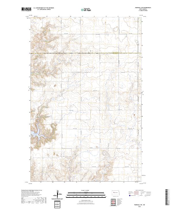
2024 Map of Parshall SW
USGS Topo · Published 2024About this map
Lucky Mound Creek Bay defines the western edge of this prairie landscape, where the waters of Lake Sakakawea meet the rolling terrain of the Fort Berthold Indian Reservation. The map documents a structured grid of rural section lines and township boundaries, including the dividing line between Mountrail Co and McLean Co. This modern survey illustrates the current infrastructure of the Great Plains, where an extensive network of gravel and section roads like 75th Ave NW and 31st St NW provides access to remote agricultural tracts and energy resources.
Find a feature on this map
20 named features on this map. Tap any name to fly to it.
Don’t see what you’re looking for? This feature index may not catch every label — zoom into the map to look around manually.
Map Details
Editions of this 2024 Parshall SW Map
This is the sole edition of this map. No revisions or reprints were ever made.
Other maps of this area

1953 · Watford City
USGS Topo · 1:250,000

1957 · Watford City
USGS Topo · 1:250,000

1967 · Watford City
USGS Topo · 1:250,000

1967 · Raub NW
USGS Topo · 1:24,000

1967 · Raub
USGS Topo · 1:24,000
1967 · Parshall SE
USGS Topo · 1:24,000

1967 · Parshall SW
USGS Topo · 1:24,000

1967 · New Town SE
USGS Topo · 1:24,000
1970 · Saddle Butte
USGS Topo · 1:24,000
1981 · Parshall NE
USGS Topo · 1:24,000