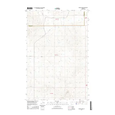
2017 Map of Parson Creek
USGS Topo · Published 2017About this map
Beehive sits as a localized point of settlement in this northern high plains landscape, situated near the intersection of several local routes such as Dry Creek Rd. The terrain is defined by the drainage systems of Parson Creek and Smith Cr, which carve through the undulating topography typical of the Montana borderlands. To the south, the elevation rises toward the prominent landmark of Blue Mtn, providing a distinct geographic anchor for the region.
Find a feature on this map
18 named features on this map. Tap any name to fly to it.
Don’t see what you’re looking for? This feature index may not catch every label — zoom into the map to look around manually.
Map Details
Editions of this 2017 Parson Creek Map
This is the sole edition of this map. No revisions or reprints were ever made.
Other maps of this area

1909 · Glendive
USGS Topo · 1:250,000

1954 · Glendive
USGS Topo · 1:250,000

1957 · Glendive
USGS Topo · 1:250,000

1958 · Glendive
USGS Topo · 1:250,000

1966 · Savage
USGS Topo · 1:24,000

1966 · Savage SE
USGS Topo · 1:24,000

1966 · Skaar NW
USGS Topo · 1:24,000
1974 · Skaar
USGS Topo · 1:24,000
1974 · Odland Dam NE
USGS Topo · 1:24,000
1974 · Skaar NE
USGS Topo · 1:24,000