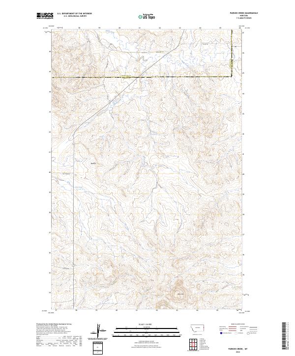
2024 Map of Parson Creek
USGS Topo · Published 2024About this map
Beehive sits within a landscape defined by rolling prairie and the drainage systems of eastern Montana. This 2024 map documents the boundary between Richland Co and Wibaux Co, a region where land use is heavily influenced by the presence of large tracts under the Farm Service Agency Interest of Montana. The terrain is marked by seasonal watercourses such as Parson Creek and Dry Creek, while Lady Brown Spring provides a rare localized water source in this dry environment. At the southern edge of the sheet, Blue Mountain rises as a significant landmark above the surrounding flats. The road network, including State Hwy 261 and Dry Creek Rd, reflects the low-density rural settlement pattern characteristic of the high plains, where connectivity often follows the path of creek beds and section lines.
Find a feature on this map
20 named features on this map. Tap any name to fly to it.
Don’t see what you’re looking for? This feature index may not catch every label — zoom into the map to look around manually.
Map Details
Editions of this 2024 Parson Creek Map
This is the sole edition of this map. No revisions or reprints were ever made.
Other maps of this area

1909 · Glendive
USGS Topo · 1:250,000

1954 · Glendive
USGS Topo · 1:250,000

1957 · Glendive
USGS Topo · 1:250,000

1958 · Glendive
USGS Topo · 1:250,000

1966 · Savage
USGS Topo · 1:24,000

1966 · Savage SE
USGS Topo · 1:24,000

1966 · Skaar NW
USGS Topo · 1:24,000
1974 · Skaar
USGS Topo · 1:24,000
1974 · Odland Dam NE
USGS Topo · 1:24,000
1974 · Skaar NE
USGS Topo · 1:24,000