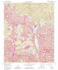
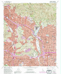
1966 Map of Pasadena
USGS Topo · Published 1988About this map
Pasadena and Altadena anchor this detailed study of the San Gabriel Valley's edge, where suburban expansion meets the southern front of the Angeles National Forest. The landscape is dominated by the steep slopes of the San Rafael Hills and Verdugo Mountains, which hem in established residential enclaves like La Canada and Flintridge. The deep cut of the Arroyo Seco serves as a central artery for recreation and infrastructure, containing the iconic Rose Bowl and the Brookside Golf Course just south of the Devils Gate Reservoir.
Find a feature on this map
70 named features on this map. Tap any name to fly to it.
Don’t see what you’re looking for? This feature index may not catch every label — zoom into the map to look around manually.
Map Details
Editions of this 1966 Pasadena Map
5 editions found
Other maps of this area

1894 · Los Angeles
USGS Topo · 1:62,500

1896 · Pasadena
USGS Topo · 1:62,500

1896 · Santa Monica
USGS Topo · 1:62,500

1898 · Santa Monica
USGS Topo · 1:62,500

1900 · Pasadena
USGS Topo · 1:62,500

1900 · Tujunga
USGS Topo · 1:62,500

1900 · Los Angeles
USGS Topo · 1:62,500

1900 · Fernando
USGS Topo · 1:62,500

1901 · Southern California Sheet No. 1
USGS Topo · 1:250,000

1902 · Santa Monica
USGS Topo · 1:62,500