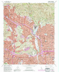
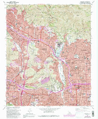
1966 Map of Pasadena
USGS Topo · Published 1994About this map
Pasadena and its neighboring foothill communities are captured here in a period of significant mid-century suburban density, where the urban grid of Los Angeles meets the steep ascent of the Verdugo Mountains and the San Rafael Hills. The landscape is defined by the massive drainage of Arroyo Seco, spanning from the Devils Gate Reservoir down past the iconic Rose Bowl and the Annandale Country Club. The institutional footprint of the region is prominent, including the California Institute of Technology (Jet Propulsion Laboratory) and Occidental College. Within the residential fabric of Altadena and La Canada Flintridge, dozens of local schools and churches, such as St Elizabeth Sch and John Muir High Sch, serve as focal points for local history and genealogy research. To the north, the boundary of the Angeles National Forest provides a stark contrast to the developed valley, marked by peaks like Brown Mtn and deep cuts like Millard Canyon.
Find a feature on this map
119 named features on this map. Tap any name to fly to it.
Don’t see what you’re looking for? This feature index may not catch every label — zoom into the map to look around manually.
Map Details
Editions of this 1966 Pasadena Map
5 editions found
Other maps of this area

1894 · Los Angeles
USGS Topo · 1:62,500

1896 · Pasadena
USGS Topo · 1:62,500

1896 · Santa Monica
USGS Topo · 1:62,500

1898 · Santa Monica
USGS Topo · 1:62,500

1900 · Pasadena
USGS Topo · 1:62,500

1900 · Tujunga
USGS Topo · 1:62,500

1900 · Los Angeles
USGS Topo · 1:62,500

1900 · Fernando
USGS Topo · 1:62,500

1901 · Southern California Sheet No. 1
USGS Topo · 1:250,000

1902 · Santa Monica
USGS Topo · 1:62,500